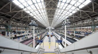
Manchester Piccadilly station map
This map gives an interactive and accessible focused solution for navigating your way around the station. The map includes the ability to change colour settings, choose between different floors and highlight key search points such as toilets, platforms, lifts, and the ticket office. Accessibility overview information is provided and where available, there’s live status feeds of upcoming departures from each platform as well as lift status.
Please note: This dynamic map solution is still in development, and we’ve been using your feedback to make this better. Information for shops will be added in early 2025.
We’re still collecting feedback and would appreciate this to help develop the map further.
This map may not be suitable for users of assistive technology, please visit the station page for information or download the PDF map.
Related pages
Manchester Piccadilly

Assisted travel
